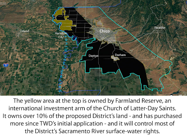
THE STORY IN MAPS.
The following map illustrates that only a portion of landowners within the proposed Tuscan Water District - the lighter pink colored lands - have sought its establishment.
To sum up:
Tuscan Water District is a project of
~540 landowner-petitioners
that will impact
~5,153 non-petitioning landowners
and also
~115,000 other Vina Subbasin residents
who depend on the Tuscan Aquifer's health.
HOW THE WATER SEEPS, AND WHY "RECHARGE" IS UNLIKELY TO WORK.
In other words, the plan is to build expensive infrastructure to pump water into a basin that leaks into other counties.
The following map, from the State of California Department of Water Resources, shows how drastically groundwater levels have plummeted in parts of the Sacramento Valley. The deep red at center is just west of the proposed Tuscan Water District. It marks an area in Glenn and Tehama Counties where hundreds of deep ag wells have been drilled. Their pumping of the Tuscan Aquifer's deepest striations amidst drought has already started to reduce water pressure in Butte County:
____________________________________________________
We oppose the formation of the Tuscan Water District and demand that Butte County officials step up to their responsibilities under State law. The groundwater belongs to the public and must be managed transparently by publicly elected authorities - not privatized as a "water bank."


